The Second World War changed the face of the Suffolk coast with large complexes of anti-invasion defences across the landscape and into the surrounding countryside, as part of the national effort to defended against the threat of German invasion. As such, Suffolk’s coast is a nationally and regionally significant Second World War historic landscape.
In this section, you can discover more about the archaeological remains, with further detail on Dunwich, Bawdsey, Minsmere, Walberswick and Westleton.
Introduction
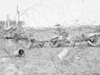
Image: Beach scaffolding at Minsmere.
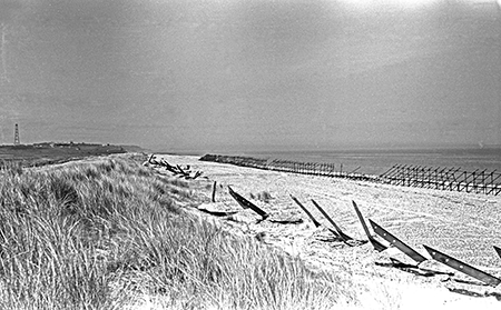
The Emergency Coastal Defence Battery programme in 1940 saw a surge in the construction of fortifications and defences along the coast. This included, but was not limited to, concrete structures such as pill boxes with their associated trenches, minefields, barbed wire, beach scaffolding, artillery and associated structures, anti-tank ditches and anti-tank blocks.
In land, the countryside was defended with a series of ‘stop line’ defences and defended nodal points, which crossed the entire county in a linear direction west from the coast. Larger villages or towns with a convergence of four or five major roads or river crossings became ‘nodal’ points, heavily defended with pill boxes, associated earthworks and various roadblocks. Leiston and Saxmundham were main nodal points.
Anti-tank obstacles and anti-landing ditches (also known as anti-glider ditches) were dug on areas of flat open land, such as heathland, which lay inland from potential invasion beaches. Cropmarks of these are visible on Aldringham Common (ARG 017, ARG 070, ARG 071, LCS 113) and on Sutton Common (SUT 057, SUT 105, SUT 111, SUT 214).
An ‘Inner Defence Line’, also known as the back line, was a second line of defence in the form of revetted trenches, which was parallel to the coast c.4-10 miles inland.
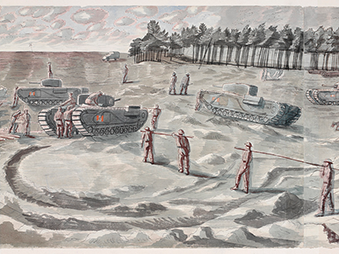
Large areas of heathland were also used as Second World War training grounds further in land. There were large training areas on Dunwich Heath (DUN 058, DUN 068, DUN 074, DUN 116), Sutton Common (SUT 213, SUT 250) and at Aldeburgh (ADB 205). Earthworks and a Suffolk Square pill box survives at North Warren, Aldringham (ADB 020). A large area was given over to training north of Orford which encompassed Sudbourne, Iken and parts of Tunstall Forest (ORF 137).
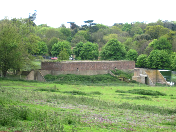
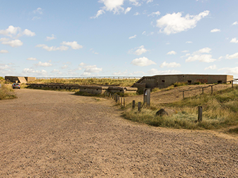
Image: Remains of radar station at Bawdsey.
Lowestoft and Felixstowe, as large international ports and harbours along this coastline, were particularly important and vulnerable, therefore were significantly defended at the port and in the surrounding area. Vulnerable landing beaches also included Walberswick, Dunwich, Sizewell, Thropness and Aldeburgh and so were heavily defended.
Orford Ness and Bawdsey are nationally important WWII sites and form part of this overall historic landscape. Orford Ness had an aerodrome and a bombing range (ORF 066) which was used to test ordnance in the 1920s and 30s. More significantly, it was the location for researching and testing Radio Direction Finding (more commonly known as radar) (ORF 080, ORF 082). This moved to Bawdsey Manor which had the first operational radar station in the country (BAW 165). Following this, radar stations were installed across Britain, including one at Dunwich (DUN 073).
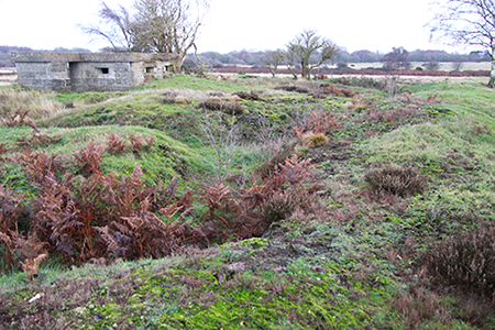
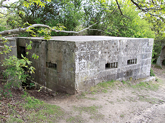
Image: Pillbox and associated earthwork trenches surviving at North Warren.
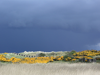
Many of the beach and coastal defences were removed after the end of the war in 1945, however elements of these impressive defences survive in the landscape, particularly the more substantial structures, including Bawdsey radar station and structures at Orford Ness. The stretch of coastline between Walberswick and Aldeburgh particularly has some of the best-preserved WWII archaeology in Suffolk, including surviving anti-tank blocks and earthworks, as this landscape is protected by RSPB, National Trust and Natural England.
The concrete pill box is the most recognisable surviving feature of this military landscape. In this part of England, pill boxes were built in the form of the ‘Suffolk Square’ which was unique to Suffolk. Associated earthwork trenches were originally dug to accompany the pill boxes, although few of these earthworks survive, a rare example survives at Hoist Covert near Walberswick (WLB 084).
Guidebooks
a series of four guidebooks detailing the physical remains of the conflict which still lie in the county's countryside and walking trails to explore
Find Out More »
Second World War Guidebooks
a series of four guidebooks to Suffolk's Second World War archaeology
Discover More »